Map Tiles
Omnimion serves map tiles suitable for small map scale (i.e. large area) visualizations, such as planetary climate data, continental vegetation coverage, or global population density.
We serve tile sets made from or directly taken from Natural Earth data, which is a public domain dataset available for free at https://www.naturalearthdata.com/. We also serve tiles made by Lukas Martinelli that are also in the public domain and can be downloaded for free from https://klokantech.github.io/ and from Lukas' GitHub repository. Finally, we serve tiles made from NASA's Blue Marble: Next Generation dataset, which is also in the public domain.
As all of the data used in the tiles we serve is in the public domain, we are able to serve the tiles without any restrictions on use. However, we charge 1 credit for 1000 tiles a hosting fee. There is also a global rate limit of 100,000 tiles per day to prevent abuse. If you need more intensive use, please contact us to discuss the rate limit or a custom solution.
You may use, modify, and redistribute the tiles for any purpose, including commercial applications, provided that you do not sell, license, or otherwise commercially distribute the tiles themselves as a standalone product or service. You may not use the tiles in a way that implies endorsement by or affiliation with the creators of the tiles without explicit permission. You may not use the tiles in a way that violates any applicable laws or regulations.
Tilesets
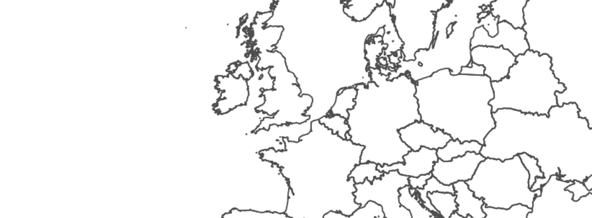
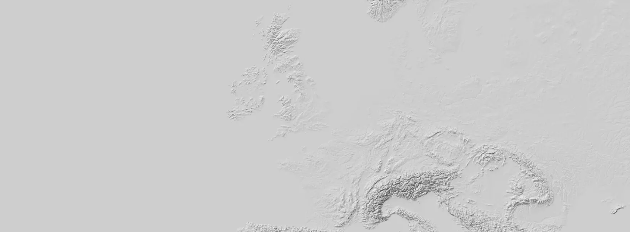
Light
Basic tiles based on Natural Earth 1:10 million vector data, with a light color scheme and minimal styling. This is an original Omnimion tileset. Template URL:
https://omnimion.com/xyz-tiles/light/{z}/{x}/{y}.png
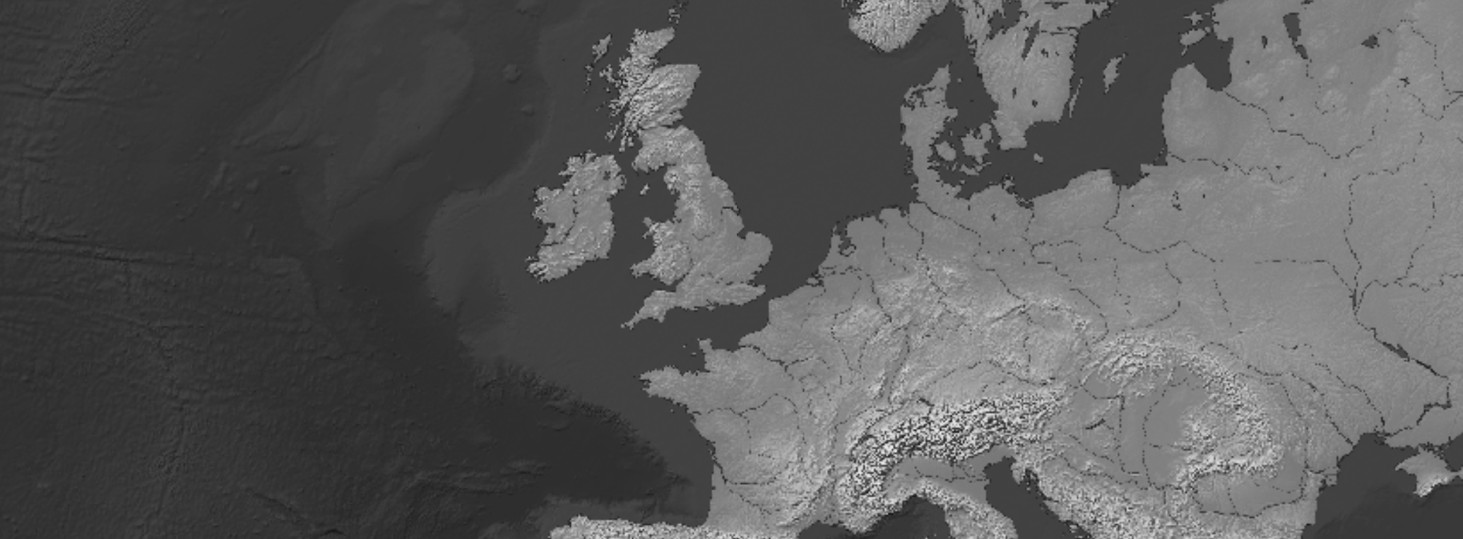
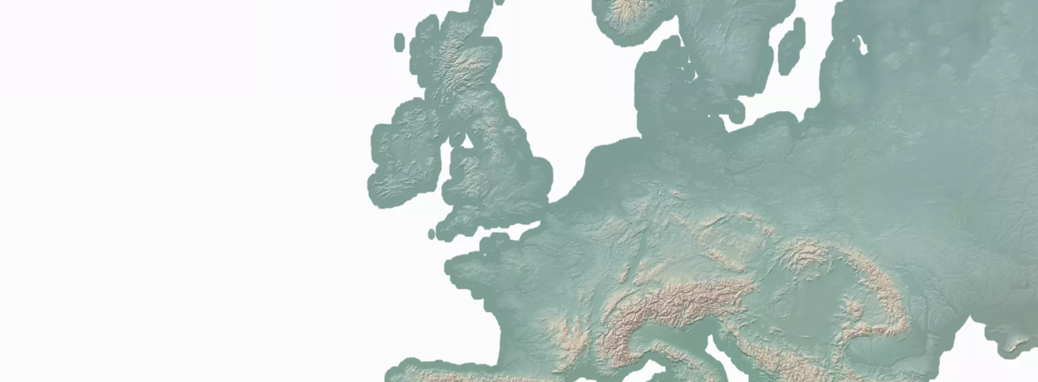
Gray Earth
Tiles made directly from Gray Earth with Shaded Relief, Hypsography, Ocean Bottom, and Drainages. Template URL:
https://omnimion.com/xyz-tiles/grayearth/{z}/{x}/{y}.png
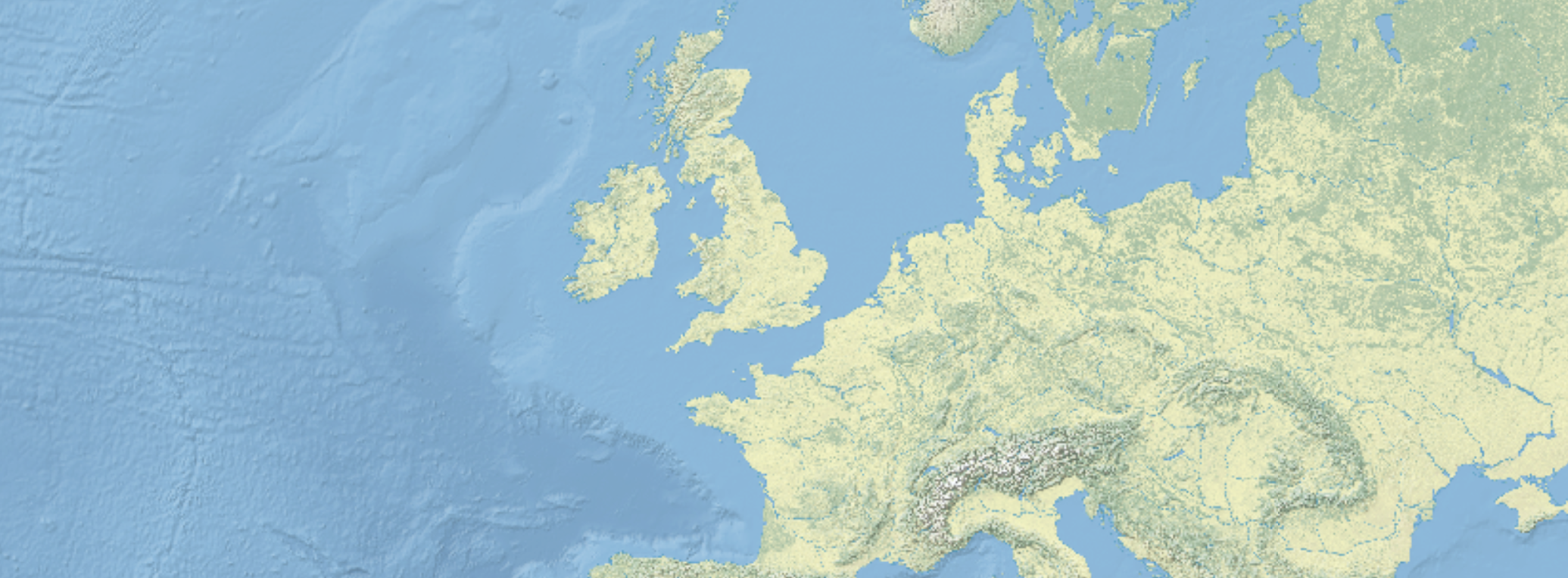
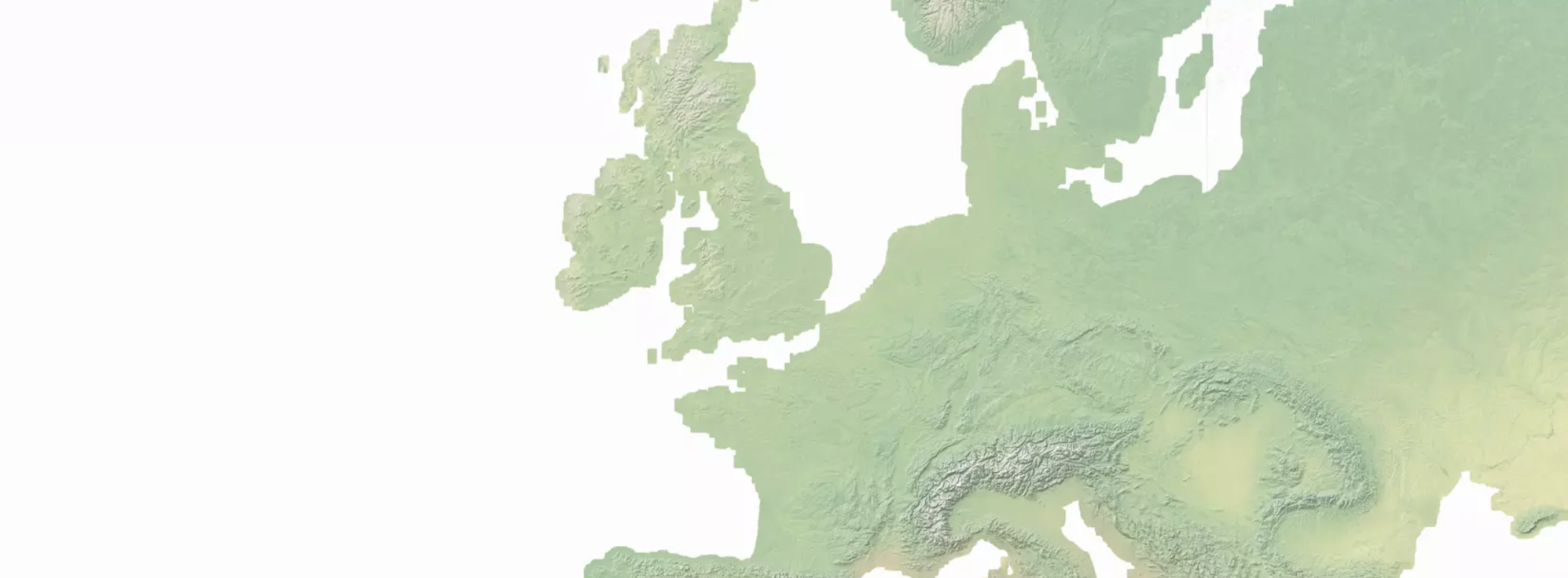
Physical
Tiles made directly from Natural Earth I with Shaded Relief, Water, and Drainages Template URL:
https://omnimion.com/xyz-tiles/physical/{z}/{x}/{y}.png
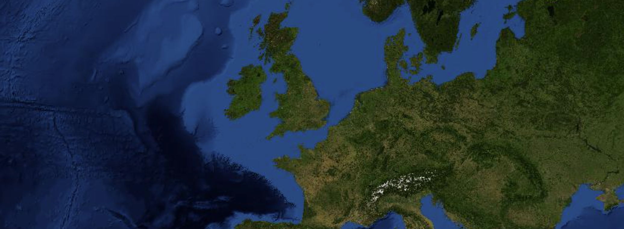
Satellite
Tiles made directly from Blue Marble: Next Generation, a dataset of global satellite imagery produced by NASA. The tiles are based on the 500m resolution version of the mosaic from July 2004. While the data is in public domain, NASA asks for attribution of 'NASA Earth Observatory' when using the data. Template URL:
https://omnimion.com/xyz-tiles/satellite/{z}/{x}/{y}.jpg
Countries, cities, roads, rivers, lakes, and urban
Omnimion serves vector tiles made directly from selected Natural Earth vector layers as:
https://omnimion.com/pg-tiles/{tileset}/{z}/{x}/{y}.pbf
Where {tileset} is one of countries, cities, roads, rivers, lakes, or urban.
Note that these vector tiles contain full geometries at all levels, so they are not simplified for lower zoom levels. Therefore, the tiles may not perform optimally at very low zoom levels. If you need better performance, please contact us do discuss you specific use case.

Lucas Martinelli's tiles
Template URLs:
https://omnimion.com/mb-tiles/natural-earth/{z}/{x}/{y}.pbf
https://omnimion.com/mb-tiles/natural_earth_2/{z}/{x}/{y}.pbf
https://omnimion.com/mb-tiles/natural_earth_2_shaded_relief/{z}/{x}/{y}.pbf
https://omnimion.com/mb-tiles/natural_earth_cross_blended_hypso/{z}/{x}/{y}.pbf
https://omnimion.com/mb-tiles/natural_earth_cross_blended_hypso_shaded_relief/{z}/{x}/{y}.pbf
https://omnimion.com/mb-tiles/natural_earth_gray_earth_hypso_shaded_relief/{z}/{x}/{y}.pbf
https://omnimion.com/mb-tiles/natural_earth_shaded_relief/{z}/{x}/{y}.pbf
For these tiles, the following endpoints are also relevant:
https://omnimion.com/mb-tiles/{tileset}/tiles.json
https://omnimion.com/mb-tiles/{tileset}/metadata
How to use
You can use the tiles in any mapping library that supports XYZ tile sources, such as Leaflet, Mapbox GL JS, or OpenLayers. Simply use the appropriate URL template for the tileset you want to use, and replace {tileset}, {z}, {x}, and {y} with the desired values. The requests require and Authorization header which can be either an OAuth2 Bearer token or an API key.
For example, to use the light raster tileset in Leaflet, you can do:
L.tileLayer('https://omnimion.com/xyz-tiles/light/{z}/{x}/{y}.png?token=<base64_encoded_api_key>').addTo(map);
To use the vector tiles in OpenLayers:
const tileLayer = new ol.layer.VectorTile({
    source: new ol.source.VectorTile({
        format: new ol.format.MVT(),
        url: 'https://omnimion.com/mb-tiles/natural-earth/{z}/{x}/{y}.pbf?token=<base64_encoded_api_key>'
    }),

});